 |
| SATURDAY, MAY 22, 3:26 p.m. - Jiuzhuang Rd. climb along Taipei's southeastern border with Xizhi. |
 |
| 3:36 p.m. - The top of the climb offers several ways down the mountain range, but broadly the options are north down to Xizhi or south down to Shiding. |
 |
| 3:52 p.m. - I went south down to Shiding township. This is the bottom of the descent crossing the Jingmei Stream. Remnants of what might have been a bridge visible. |
 |
| 4:00 p.m. - Jingmei Stream, Shiding township, Taipei County. National Highway 5 (top o' pic) tunnels through the mountain to Taipei not far from where the Jiuzhuang Rd. climb started. |
 |
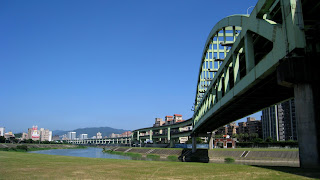
| MAY 31, 2:14 p.m. - Keelung River from Chenggong Bridge. |
 |
| 2:16 p.m. |
 |
| 3:17 p.m. - Riding east on backroads to Keelung city and the coast. |
 |
| 3:56 p.m. - East coast. Keelung Island at the upper right. |
 |
| 4:19 p.m. - I rode north up to Yehliu along Rte. 2, but didn't enter the geopark as it was late in the day. |
 |
| Popular place for wedding photos. |
 |
| 4:38 p.m. - Yehliu fishing harbor. Headed back to Keelung and then home. |

