Weekend of light climbing and exploring:
 |
| SATURDAY, NOVEMBER 18, 8:23 a.m. - Less than a mile riding east from my apartment is the start of Chongde Street which climbs up into Fudekeng (富德坑) Cemetery. This is a view a bit up the climb looking back northwest with the Dunhua Towers as the only visible landmark, if one can consider them that. |
 |
| 8:13-8:20 a.m. - There is a considerable Muslim section of the cemetery! Who knew (aside from the Muslims)? Sure there's a Grand Mosque right near where I live, but it's hardly grand (should be named Quaint Mosque compared to structures in the greater Muslim world). But apparently there are enough resident Muslims to die here and want to stay here. |
 |
| 8:35 a.m. - Navigating the narrow stairs and paths of the cemetery. |
 |
| 8:40-8:59 a.m. - Itsa hyuge sprawling cemetery. Apparently Taiwanese want to give the dead the best views. In the lower pic as the road continues to climb, Dunhua Towers can still be seen at the mid-left, and now Taipei 101 also visible. The three buildings in the foreground, I think, are the funeral home and crematorium. |
 |
| 9:23 a.m. - At the top of the climb, I opted for the left fork of the road down Yanjiuyuan Rd (named after the Academia Sinica that sits at the bottom of it), which on my paper map looked like a simple, straight-shot to eastern parts of Taipei where I'd never been. What I didn't know is that after all that climbing, it's a bit of a screaming downhill and lots of fun through hardly urban landscape. These pics, on the way down (I wasn't screaming down it on my clunker), are still considered Taipei! |
 |
| 10:13 a.m. - Ending up in far east Taipei, I found my way back along Zhongxiao East Rd to Xinyi District. Zhongxiao East Rd, running east to west, is along the right side of the pic and the yellow paint marks MRT City Hall Station. Those buildings ahead are along Keelung Rd. There is major construction going on in this area, and in a few years time the Hankyu Building, W Hotel and Taipei Bus Depot East will rise on this site. When I arrived in Taiwan, there was nothing here. |
 |
| 10:31 a.m. - It's hard not to shoot Taipei 101 from anywhere in Taipei, even directly under it. |
Nikon N70, Ilford XP2 Super, CD-R:
 |
| Fudekeng Cemetery. |
 |
| SUNDAY, NOVEMBER 19, 8:55 a.m. - Saturday was east. My paper map indicated roads to explore to the south, pushing the limits of places to discover in Taipei. They took me to Muzha and Maokong, meaning hills. I climbed maybe halfway up the hills to Zhinan Temple. This is the Wanshou Rd. parking lot, shooting south. |
 |
| 8:56-8:59 a.m. - An arcade leads from the Wanshou parking lot to the temple. It's kind of a backdoor way to get there, as the main entrance to Zhinan Temple, I think, is from Zhinan Rd. which is a different route up the mountain to Maokong. |
 |
| 9:03 a.m. - Making my way up to the temple. |
 |
| 9:24 a.m. - A very rare day wearing a sleeveless shirt. |
 |
| 9:17 a.m. - Oddly I don't have any shots of the actual temple. Maybe I was being very zen. Visiting a Taoist temple but only suggesting the temple. |
 |
| 11:24 a.m. - Xindian riverside bikeway near Gongguan, approaching home. |
 |
| 11:34 a.m. - Treasure Hill, a housing community of military dependents. That's a "thing" particular to Taiwan and its history. After Chiang Kai-shek lost the Chinese Civil War to Mao and his Communists and re-located his forces to Taiwan in 1949, soldiers who fought for him were guaranteed housing, as well as for their dependents. Most housing communities for military dependents have evolved and disappeared, but Treasure Hill remains. It will eventually gain cultural protection status and evolve into an artists' village without the residents necessarily being evicted. |
 |
| Riverside bikeway along Jingmei Stream in Muzha. |
 |
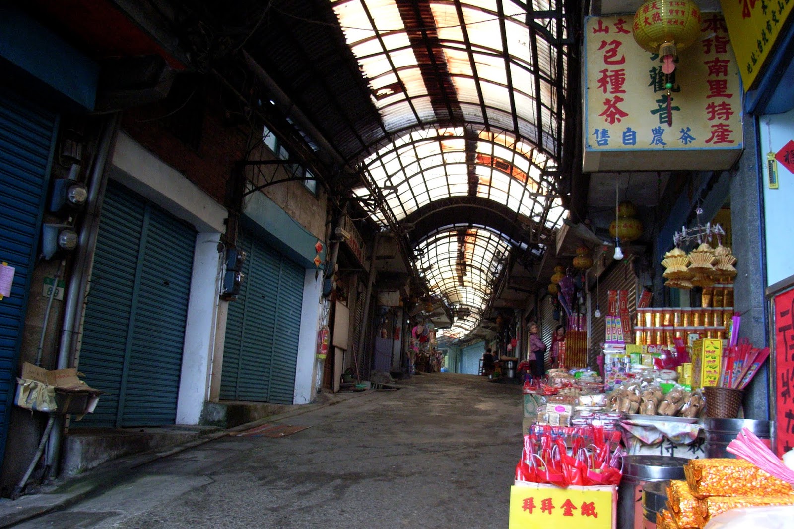
| Stalls after passing through the arcade leading to Zhinan Temple. Nothing open at that time of morning. |
 |
| Two views from the same bridge over Jingmei Stream, on my way home. Riverside bikeways are being constructed in the top pic, completed in the bottom. The bikeways would become more or less seamlessly integrated throughout Taipei's waterways over the coming years. |
bonus:
 |
| November 26, 9:59 a.m. - Da'an Park from the main library stairwell. I'm only posting this because I mentioned the Taipei Grand Mosque, which is in the upper left quadrant of this pic - the domed building. It's on Xinsheng S. Rd (Da'an Park west). Quaint, no? The church towards the right seems much grander. |